Order your satellite imagery now
For more than 30 years, Geocarto International Centre Ltd. has been a leading distributor of satellite remote sensing data and provider of image processing services in the Asia Pacific region.

Selection of our scientific and professional periodicals, books, images, maps and other products.
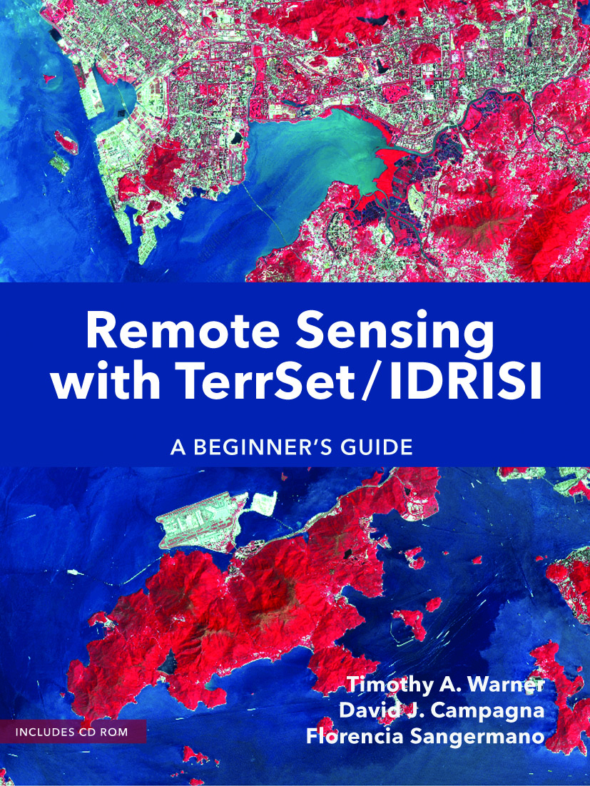
This book provides a comprehensive introduction to the TerrSet®/IDRISI® remote sensing software package. With clear instructions and more than 300 color illustrations, the text is ideal for students and professionals seeking a hands-on and guided exploration of the fundamental issues in remote sensing and image processing.
- Introduction
- Displaying remotely sensed data
- Importing, pre-processing and
exporting image
- Enhancing images spatially
- Image ratios
- Spectral enhancement techniques
- Introduction to classifying multispectral images
- Supervised classification
- Soft classification
- Classification error assessment
- Image change analysis
| Year | 2017 |
| Pages | 390 pages |
| Dimension | 19 × 26 cm |
| Price | Book: USD$ 55.00 Postage: USD$ 25.00 |
| Total: USD$ 80.00 |
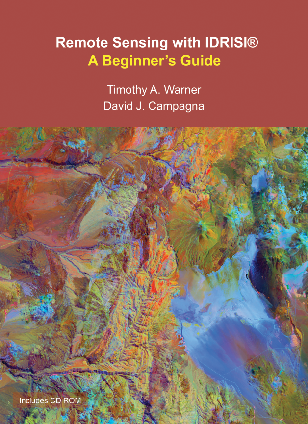
This book provides a comprehensive introduction to the IDRISI® remote sensing software package. With clear instructions and color illustrations, the book is ideal for students and professionals seeking a hands-on and guided exploration of the fundamental issues in remote sensing and image processing.
| Year | 2013 |
| Pages | 308 pages |
| Dimension | 19 × 26 cm |
| Price | USD$ 60.00 |
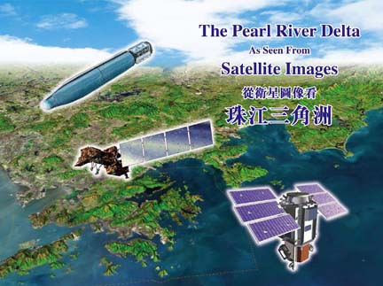
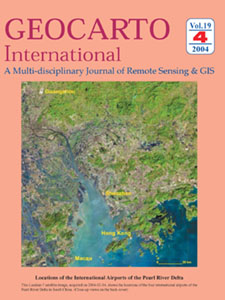
This book comprises 4 main sections. Section 1 presents night-time images of the Pearl River Delta region, and Hong Kong & its environs. Section 2 contains images of 15 m resolution acquired by Landsat-7 satellite. Section 3 includes photos of 2 m resolution obtained by the Corona satellite. Section 4 features colour images of 60 cm resolution taken by the QuickBird satellite. These images were collected in the period 1969 – 2008. They show the spectacular changes in the Pearl River Delta region over the past 39 years.
| Year | 2008 |
| Pages | 128 pages |
| Dimension | 11.25″ x 8.25″ |
| Price | USD$ 25.00 |
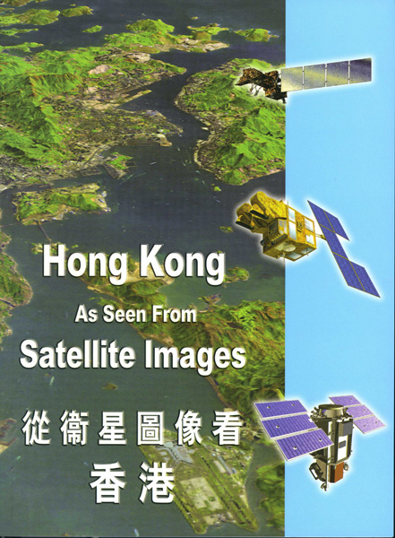
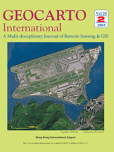
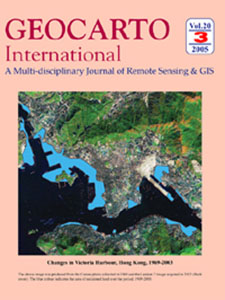
This book comprises spectacular images of the Hong Kong Special Administrative Region acquired by Landsat-5, Landsat-7. SPOT-5, and QuickBird satellites on different dates. In addition, a black and white photo collected by Corona satellite in 1969 is included. When it is compared with a Landsat image acquired in 2003, the changes in Victoria Harbour over that period are shown vividly.
| Year | 2005 |
| Pages | 80 pages |
| Dimension | 19 × 26 cm |
| Price | USD$ 17.00 |
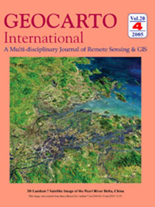
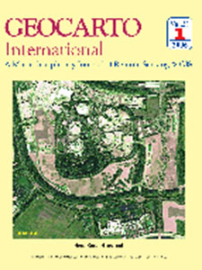
Geocarto International, a multi-disciplinary journal of Remote Sensing and GIS, is the first English language periodical on Remote Sensing and GIS published quarterly in Asia by Geocarto International Centre Ltd. from 1986 to 2006 for international circulation.
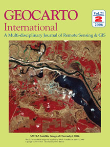
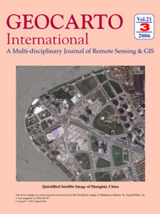
Effective from January 1st, 2007, Geocarto International is published and distributed by Taylor and Francis in the UK. Papers for consideration should be submitted directly to Taylor & Francis atgeocartointernational@tandf.co.uk
For general enquiries or to place an order, please contact Taylor & Francis Customers Services at customerservices@taylorandfrancis.com

Remote Sensing/GIS Research & Development Section Section Editor: Kamlesh Lulla Stan Aronoff (Canada), James H. Everett (U.S.A.), G.M.Foody (U.K.), Kevin P. Gallo (U.S.A.), J.L.van Genderen (Netherlands), R.Gomber (Belgium), P. Coppin (Belgium), John R.Jensen (U.S.A.), Choen Kim (Korea) V.Klemas (U.S.A.), Deren Li (China), Liew Soon Chin (Singapore), A.K.Milne (Australia), Nik Nasruddin Mahmood (Malaysia), Stanely A. Morain (U.S.A.), Shunji Murai (Japan), Pan Xishe (China), Kevin P.Price (U.S.A.), R.R. Navalgund (India), Susan Ringrose (Botswana), Robert A. Ryerson (Canada), Anthony Yeh (Hong Kong)
Remote Sensing/GIS Education & Teaching Section Section Editor: M. Duane Nellis Paul Bauman [Remote Sensing Images Editor] (U.S.A.), Sara Bednarz (U.S.A.), David Butler (U.S.A.), Frederick Engle (U.S.A.), Charles Fitzpatrick (U.S.A.), Ray Lougeay (U.S.A.), Maria del Pilar Cereceda Troncoso (Chile), Stephen Walsh (U.S.A.), Josef Strobl (Austria)

For small amount payments.
For more than 30 years, Geocarto International Centre Ltd. has been a leading distributor of satellite remote sensing data and provider of image processing services in the Asia Pacific region.